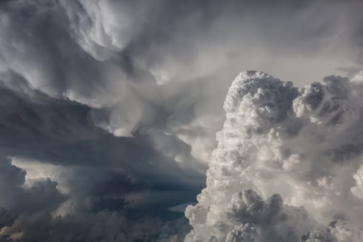
Pilot photographs 'rare' Yorkton storm from the sky
Pilot Matt Melnyk has never seen a storm like this in his 15 years of flying

Pilot Matt Melnyk was flying through the air while storms wreaked havoc in Saskatchewan on Sunday.
Melnyk flies with WestJet Encore. He is based in Calgary, but often flies in Saskatchewan and Manitoba. At the time, he was travelling from Saskatoon to Winnipeg and then back to Saskatoon.
The crew was warned of severe weather and funnel clouds in their planned flight path just before they were going to take off to Manitoba.
He wasn't worried about the storm, but noted it was stronger than anything he'd ever seen.

Melynk noted the cloud tops were at about 17,678 metres (58,000 feet) whereas the average prairie cloud tops are at about 10,668 metres (35,000 feet.)
"It was very rare."
They were flying at 7,620 metres (25,000 feet).
He left Saskatoon, piloting the Dash 8 q400, for flight 3274 at 4:40 p.m. CST on Sunday.

They were told that in addition to the severe thunderstorms there were reports of funnel clouds, and a potential tornado by Yorkton.
The crew decided to take an alternate route. They had to deviate 157 kilometres (85 nautical miles) off course to avoid the storm.
"We started flying towards Winnipeg and then deviated our course, at 25,000 feet and that's when I got those photos," he said.
"I'm a photographer and it's a hobby of mine and I decided to have my camera with me because it is summer and I thought that there would be some interesting photo opportunities and I had it with me, luckily."
They arrived in Winnipeg just after seven before turning back to Saskatoon.

Melnyk explained that cloud tops this high are more normal in the southern states — Texas for example.
The more intense a storm the higher it grows in cloud height.
"A thunderstorm will grow as high as the atmosphere lets it," he said.
Canada's atmosphere ends at the Tropopause, just beyond the lowest region of the atmosphere which is about 12,192 metres (40,000 feet)
"This means this particular rare storm had a significant amount of energy to grow to such a cloud height."
- Tornado turns family home to rubble near Melville, Sask.
- 6 homes in RM of Cana 'seriously' damaged by tornado
- Photographer captures tornado while hunting lightning
The flight did not end up experiencing turbulence because of the pilots' flight path change, staying a safe distance away from the severe weather.
The crew arrived back on Saskatchewan soil at 8:20 p.m. CST.
Around that time, people began to learn that two tornadoes did touch down and cause a huge amount of damage by both Yorkton and Melville.
