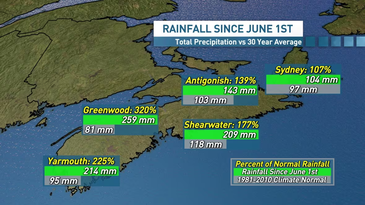
One extreme to the next: June completely erased Nova Scotia's rain deficits of early spring
In Halifax, the past 11 days have been the wettest and gloomiest start to a summer since 2009

When the month of June began, Nova Scotia was on fire.
On June 1, temperatures soared into the high 20s and low 30s across the province, as crews battled wildfires in the Upper Tantallon area and in Shelburne County.
At that point, it had been one of the driest springs on record, but there was hope on the horizon.

A huge rain event in early June did bring some relief and that was just the tip of the iceberg.
What followed has been a relentless parade of unsettled weather.
The past couple of weeks has been particularly difficult along the Atlantic coastline. A persistent onshore tropical flow has brought clouds, periods of heavy rain, thunderstorms, drizzle and fog.

In Halifax, the past 11 days have been the wettest and gloomiest start to a summer we've seen since 2009.
The good news in all of this?
The very wet June and start to July across the province has all but erased the rain deficits of early spring.

In Halifax, for example, the total rainfall since April 1 is now 339 millimetres, which is 95 per cent of normal for that three-month period.
In the Annapolis Valley, totals in Greenwood since April 1 are 134 per cent of normal for the three-month period.
Elsewhere on the mainland, three-month totals are also in the 80 to 100 per cent range.
Cape Breton is still drier than normal at just 63 per cent of normal in Sydney since April 1.
Trending in the right direction
The good news is, there's nowhere to go but up, so we are looking at a brighter forecast over the next few days, especially along the Atlantic coastline.
The warm, damp, foggy, tropical flow is coming to an end and we'll see more sunshine in the mix later this week and into the weekend.
But the bad news is, the blocking-high pattern over the North Atlantic isn't going away anytime soon, so we should temper our expectations for a complete weather reversal right away.

Next week will not bring wall-to-wall sunshine, however it doesn't look nearly as dark, gloomy or damp — and there's more potential for sunshine.
In the long range, forecast models are signalling a breakdown of the blocking high as we move toward mid-July, which should favour a brighter overall forecast for Nova Scotia.

