Maritimers preparing for Hurricane Irene
Some people in the Maritimes are heeding the call of warning of emergency officials in preparation for Hurricane Irene.

The path of the storm is shifting eastward and directly toward the Maritime region. Local weather forecasters are watching closely because it's moving northward over some of the warmest waters in the Atlantic Ocean.
"That puts somewhere eastern Canada feeling some sort of impact from [the hurricane]," said Chris Fogarty, program supervisor of the Canadian Hurricane Centre.
"The degree of impact is still unknown, but with the tracking of it now looking like it's more probable to stay over the ocean, that increases the probability of strong winds getting into Canadian land areas," he said.
People are being advised to get ready just in case.
Stock up
"If you're down on supplies such as bottled water, maybe some extra batteries, some food that's non-perishable," said Bill Lawlor, director of Disaster Management for the Canadian Red Cross in New Brunswick.
Lawlor advised the public not to wait until the weekend to pick up supplies.
"I can assure you wherever Hurricane Irene ends up falling, there will be a mass exodus to the grocery stores and you want to make sure you can get some things before they should run out, in the event they do run out," he said.
Nova Scotian boaters who tie up their boats at the Dartmouth Yacht club are well aware of the dangers of hurricanes. The marina was destroyed by Hurricane Juan in 2003.
Rob Sabadash was going to set sail southward on Friday, but he's changed his plans.
"You can get into a lot of trouble out there. The seas, they're calling for up to five to 10-metre seas out in the gulf of Maine during this storm and we've got a 45-foot boat and that's a little bit too much for us to take," said Sabadash.
Staff at the Dartmouth Yacht Club say they have a hurricane plan. If it looks imminent, boats will be pulled out of the water and everything gets tied down.
Possible power outages
New Brunswick's Emergency Measures Organization is also asking people to be prepared, especially in the case of power outages.
Branches are often the first things to fly when winds pick up, and power outages often follow if branches land on power lines.
Greg MacCallum, the organization's deputy director, said people should plan for things like power outages.
"In the worst case scenarios, because their homes may be without power, they should certainly be prepared — if not to leave their homes and go someplace where they can have more amenities and comforts to make sure they have their own preparedness sorted out."
In Halifax, crews were busy Wednesday preparing for a possible storm.
"I spoke to my boss this morning and by 11 o'clock we had already taken about 20 or 30 calls. People want you there now," said Fraser Hart, with Arbor Plant Health Care.
Flooding
Claude Cote, a meteorologist for Environment Canada, said the agency has been keeping a close eye on water levels around the province.
"The water level in many of the tributaries to Saint John went up 60 to 100 cm in the past five days. These values are higher than what we experienced in 2010, however, these are well below the flood stage," said Cote.
However, Environment Canada is recording large increases in water levels in the Nashwaak River. Cote said the Nashwaak can rise quickly when it rains.
"I'm sure that people who have regular flooding of their basements they'll be watching the storm track pretty carefully this weekend and if it looks like its going to dump a lot of rain they'll be lifting stuff off the basement floor," said Peter Salonious, who is with the Nashwaak Watershed Association.

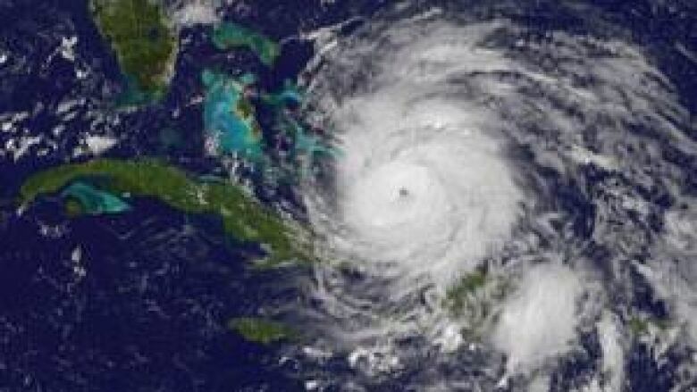
Currently, Hurricane Irene is a Category 3 hurricane moving around the Bahamas, with winds of about 200 kilometres per hour.
Forecasters say Irene could strengthen into a Category 5 hurricane by the time it comes ashore in the U.S.
If it hits the Maritimes, it's predicted to be late Sunday or early Monday.