Pilot project making winter travel safer for people in Pond Inlet, Nunavut
'The climate is not the same today as it was maybe 10 years ago, and I just want people to be safe'

Pond Inlet's Andrew Arreak spends much of his winter travelling on the sea ice around his community to make sure others can safely do the same.
"Each year snow is coming earlier, and sometimes the ice breakup comes earlier as well, and I just want people to have safe travels."
Arreak is the local research coordinator for SmartICE, a unique sea ice monitoring system developed for coastal communities by researchers at Memorial University in Newfoundland, and is being piloted in Pond Inlet.
The program, which is also being piloted in Nain, Nunatsiavut, uses a combination of sea ice sensors and satellite imagery to map ice conditions in areas that community members use most, but — due to a changing climate — are less predictable and increasingly dangerous for travel.
Community-driven research
This winter will mark year two of the Pond Inlet pilot, and Arreak is preparing for the work ahead.
He starts off the season by "asking the community for feedback" on where he should deploy the SmartICE sensors, which measure the thickness of the ice.

Ideally, the sensors are maintenance-free during the monitoring season, so Arreak spends the months that follow downloading the data, which is recorded regularly but averaged and transmitted once a day via satellite, onto his computer.
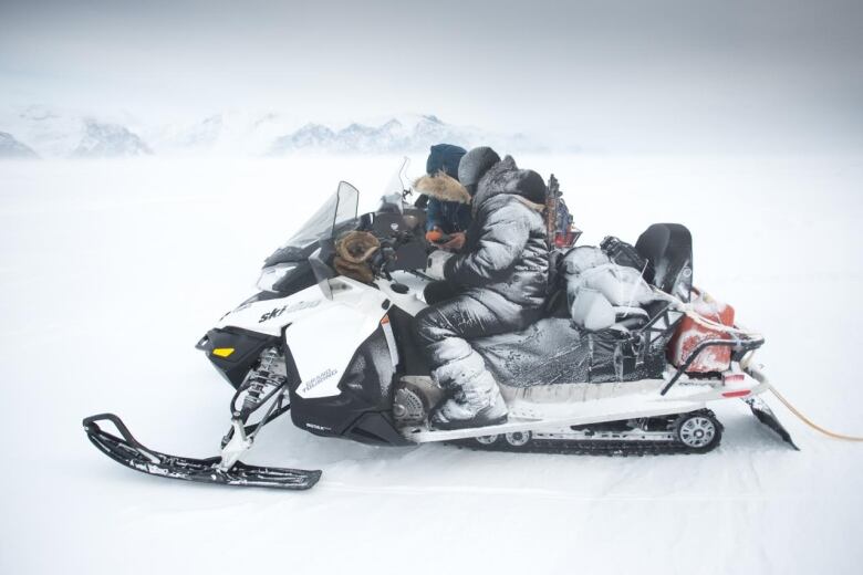
But Arreak gets out on the land as well — dragging the 'SmartQAMUTIK,' a large sensor that works using electromagnetic fields to measure the thickness of the ice, behind his snowmobile.

"I love it," he says. "I get to go on the sea ice, do a bit of harvesting if I have time, and I can tell local people how thick the ice is on areas they go camping or hunting."
Arreak uploads the data he gathers onto the SmartICE server, which produces user-friendly maps that correspond with a simple "traffic light system."
Areas with thick ice that are relatively safe for travel appear in green. Areas necessitating more caution appear in orange, and "no-go" spots are red.
"I print the maps out and post them in local areas, such as the stores or the [Hunters and Trappers Organization] or the [search and rescue] team, and I email it to people as well," says Arreak.
Building community knowledge
Arreak says he feels lucky to be part of the SmartICE team, and tries to pass on the knowledge he is gaining to others in his community.
"With SmartICE I can bring somebody along with me and give a little employment to local people.
"I also like to teach people about how the instruments work, or talk to them about what they would like to see, and also I like to bring youth and show them the ropes."
He hopes to one day see SmartICE operating in all Nunavut communities.
"The climate is not the same today as it was maybe 10 years ago, and I just want people to be safe."
'Looking to the future'
"We're piloting in two communities, but there's lots of demand, so of course we're looking to the future," says SmartICE project leader and Memorial University professor Trevor Bell.
Bell wants to spent the next couple of years commercializing SmartICE so that it can run as a social enterprise in other Northern communities.

"The idea here is that it's a Northern social enterprise, so that's an enterprise that will operate in communities by Inuit for Inuit."
Bell says his team would play a role in training and support, but he wants to equip community members with the skills to be able to run the program themselves.
He thinks SmartICE could be a commercial service that would appeal to industry, but also hopes the "the federal and territorial governments will "recognize it as an essential service for safe travel, especially under changing climate conditions."
Anything that extends the life of the program is something Arreak says his community would like to see.
"I've been getting great feedback, and people want me to continue this project as long as I can."