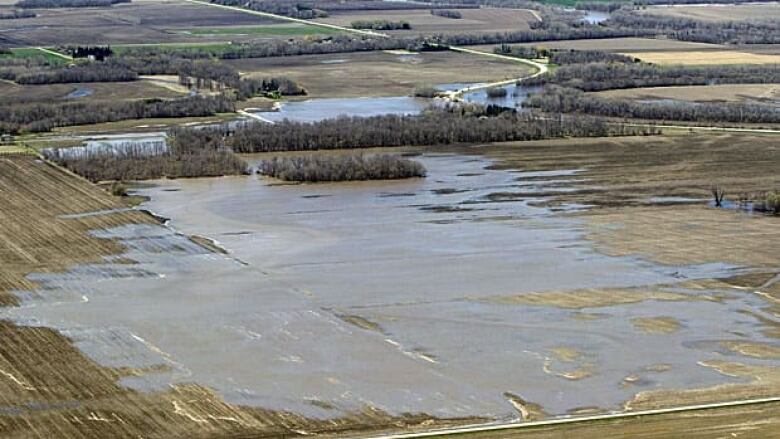
Controlled spill slows river's rise
2nd day of unprecedented water diversion

Latest
- Water flowing one kilometre every five hours
- Deliberate breach helps slow river's rise
- Premier promises compensation for property damage, lost income
- New warning notices around Portage Diversion
A government controlled spill of the Assiniboine River has slowed the rate of the river's rise downstream, Manitoba flood officials said Sunday.
"Today, even though more water is coming down the Assiniboine River, water levels downstream of the controlled release have not risen. The controlled release is within the much larger area that would be at risk of flooding by an uncontrolled breach," Manitoba said in its latest flood bulletin.
"The water is dispersing slowly across fields and then filling behind roads and spilling at low points and is now flowing into the Elm River channel that eventually flows into the La Salle River," the bulletin said.
Officials are keeping the flow of the deliberate breach to a rate of 500 cubic feet per second — or about one kilometre every five hours. They had warned that the rate could increase on Sunday, but so far that has not happened.
[IMAGEGALLERY galleryid=547 size= small]
Manitoba on Saturday made a deliberate diversion of Assiniboine River water to avoid a wider, uncontrolled flood. The controlled release of water could inundate a 180 square kilometres area east of the city of Portage la Prairie as Assiniboine water runs into the La Salle River watershed.
The province has struggled with record flooding along the Assiniboine in central and western Manitoba and the breach is intended to take pressure off dikes downstream and spare 850 homes from being inundated.
Floodwaters have swamped low-lying farmland, cut off roads and forced more than 1,300 people to leave low-lying areas in Brandon, where temporary dikes are the only thing keeping homes in the city's valley dry. Winnipeg, to the east, is not affected.
Trying to avert worse problems
A cut was made early Saturday at the Hoop and Holler Bend, east of Portage la Prairie, to divert the bulging river and reduce the risk of a potentially catastrophic breach downriver.
At the same time, the province announced the amount of land to be inundated, once the full extent of the diversion is reached, will be less than initially projected, some 180 square kilometres instead of 225 square kilometres.
Fears loss of farm
"Resignation, rage, sadness, everything. It’s up and down," said Robert Stanger, who lives three kilometres from the cut, on a farm built by his father 50 years ago. Stanger didn’t have the heart to tell his father, who died Friday, that his life’s work might soon be swamped or lost.
"It wouldn't have made it any easier," Stanger said in a shaky voice. "I hope he didn't know."
Selinger said officials were directing the water to minimize damage to the farms and communities sitting in its path. If necessary, they’ll make cuts in roads, since they can be rebuilt quickly.
The CBC's Alex Freedman said authorities don't know exactly how many houses are in the path of floodwaters. The initial estimate was that 150 homes faced flooding, but it appears the number will be fewer.
Residents have expressed frustration with a lack of information during the build-up to the floodwater diversion.
"Mass confusion," said Joel Aberdeen, who lives about a kilometre from the Hoop and Holler Bend. He was advised his land likely won’t be flooded, but it’s being protected by tube dikes just in case.
"You don’t know what to expect, so how do you prepare for it?"
Emergency Measures officials were going door to door during the night to get information to residents, but Selinger said he understood the anger.
"Citizens have every right to be concerned about not getting information as soon as possible."
The river is not expected to crest until some time between May 18 and 20 and its flow was already at half the rate of Niagara Falls earlier this week, according to provincial officials.
With files from The Canadian Press